
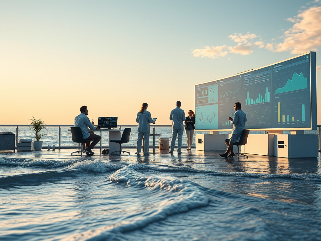
WASHINGTON — The Gulf Research Program (GRP), operating under the National Academies of Sciences, Engineering, and Medicine, has announced new funding exceeding $7.3 million to support four interdisciplinary research initiatives focused on sea-level change in the Gulf region. The projects are designed to deepen scientific understanding of sea-level variability and long-term rise, while strengthening planning, preparedness, and resilience for coastal communities.
The funded initiatives aim to improve future sea-level rise projections by combining high-resolution climate and ocean modeling, machine learning techniques, stakeholder engagement, and detailed analysis of both physical and human-driven coastal processes. By clarifying how relative sea level changes across the Gulf and translating that science into practical tools, the projects seek to deliver projections that are more accurate, actionable, and tailored to regional needs. Together, the efforts will provide governments, agencies, and local communities with stronger evidence to guide long-term adaptation strategies and disaster risk planning.
Reliable, region-specific sea-level information is critical for resilience planning across the Gulf Coast, said Michael Feldman, program director for the Gulf Environmental Protection and Stewardship Unit within GRP. He noted that the supported research will help decision-makers anticipate future conditions and make informed, forward-looking choices.
One of the funded projects, titled Shifting Land, Rising Seas: Forecasting How Human and Climate Drivers Shape Gulf Coast Sea-Level Futures, is led by Andrew Hoffman of Rice University and received nearly $2 million in funding. The project addresses key uncertainties in Gulf Coast sea-level rise projections by integrating vertical land motion, hydroclimate variability, and community vulnerability into a unified forecasting framework. Current projections often underestimate the combined influence of land subsidence, sediment loading, groundwater and hydrocarbon extraction, and atmospheric variability. To close these gaps, the research team will combine geodetic measurements with poromechanical models of land compaction and glacial isostatic adjustment, along with large climate model ensembles that capture short-term and decadal atmospheric patterns. These physical projections will be paired with a dynamic vulnerability index that incorporates data on infrastructure abandonment, population movement, and housing trends. Expected outcomes include high-resolution subsidence datasets, improved probabilistic sea-level projections, integration with the Framework for Assessing Changes to Sea-Level platform, and interactive visualization tools to support coastal planning.
Another funded effort, Predicting Submonthly Gulf Coast Sea-Level Variability and its Effect on Flooding, is directed by Christopher Little of JANUS Research Group LLC and awarded more than $1.5 million. This project focuses on short-term sea-level variability and its role in coastal flooding. The team will quantify how sea-level anomalies relate to flooding characteristics such as duration, extent, and severity using high-resolution coastal reanalysis data. Researchers will also investigate the origins of submonthly sea-level fluctuations, distinguishing between local and remote drivers, and evaluate how accurately global climate models capture these dynamics. A hybrid forecasting system that combines statistical and dynamical methods will be developed to improve flood predictions. The results will be incorporated into NOAA’s High Tide Flooding Outlooks, enhancing operational forecasting products. Anticipated outputs include probabilistic tools for localized flood prediction, better understanding of model biases, and prototype products usable by emergency managers and planners.
The third project, Gulf Sea-Level Rise: Harnessing Global and Regional High-Resolution Models to Enhance Projections, known as SHORE, is led by Ping Chang of Texas A&M University and received close to $2.9 million in funding. This two-phase initiative will generate advanced projections of Gulf Coast sea-level rise using high-resolution global and regional climate and ocean models. During the first phase, researchers will expand high-resolution Community Earth System Model ensembles across a range of emissions scenarios and downscale them using ultra-high-resolution coastal models that simulate tides, waves, river discharge, and estuarine processes. These simulations will produce detailed flood and inundation maps at sub-100-meter resolution, validated with satellite and in situ observations. In the second phase, the team will transition to next-generation climate models capable of simulating sea-level rise driven by land ice melt and freshwater fluxes. The project will deliver daily-to-decadal projections, probabilistic risk estimates, and visualization tools developed in collaboration with end users.
The fourth funded initiative, High-Resolution, Scenario-Based Sea-Level Projections: Integrating Vertical Land Motion, Ocean Dynamics, and Atmospheric Forcing, is led by Laurent Cherubin of Florida Atlantic University and awarded $900,000. This project emphasizes data integration through machine learning and community decision support. The research team will develop a graph-based probabilistic forecasting framework that combines predictors such as ocean heat content, atmospheric indices, and vertical land motion. The approach is designed to capture both local processes and large-scale climate connections, producing ensemble-based projections that complement traditional deterministic models. In partnership with Florida Sea Grant and coastal communities, the team will co-develop an interactive decision-support platform offering scenario-based projections for 2030, 2050, and 2100, along with training workshops and outreach materials to strengthen local adaptive capacity.
The Gulf Research Program is an independent, science-driven initiative established in 2013 using funds from legal settlements related to the 2010 Deepwater Horizon oil spill. Its mission is to advance and apply scientific knowledge to improve offshore energy safety, environmental protection, and the long-term well-being of Gulf Coast communities. The program supports innovative research, guides data and monitoring efforts, and builds networks that deliver lasting benefits for the region and the nation.
The National Academies of Sciences, Engineering, and Medicine are private, nonprofit institutions that provide independent and objective analysis to help address complex national challenges and inform public policy in science, engineering, and medicine. They operate under a congressional charter granted in 1863 and signed by President Abraham Lincoln.


Leave a Reply